By WMBD-TV
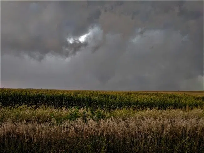
MCLEAN COUNTY – Thunderstorms last Thursday, June 13, left their mark on eastern McLean County, carving out a notable path of wind damage. The National Weather Service in Lincoln has identified five separate tornado touchdowns. They are still finalizing their reports.
But what happened to cause this? Has this happened before?
First, let’s look back at the radar images from that evening, including the individual warnings that were issued.

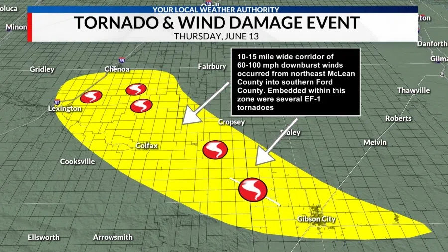
The zone of storm damage started around Lexington and Chenoa, then continued southeast toward Colfax and Anchor, becoming more focused into Ford County. The first three tornadoes occurred near Lexington and Chenoa, rated EF-1 with winds of 100-110 mph.
The other tornadoes, also EF-1, touched down near Anchor, with one tornado staying on the ground for 7 miles as it tracked southeast from near Anchor to Gibson City.
Meteorologists rate tornadoes using the Enhanced Fujita Scale. That scale goes from 0 to 5 with 5 being the most dangerous (and rarest).
Survey crews, usually with the weather service, go out and assess damage, look at the scene and figure out the tornado path and intensity. The wind speeds are simply estimates based on the type of damage found.
In this case, the weather service’s survey crew notes it was very difficult to decipher the damage from straight-line winds vs. where tornadoes touched down.
How did this corridor of winds form? Let’s explain.
These powerful thunderstorm winds were a result of what we call a downburst. This is a result of rain-cooled air that shoots down from a storm. Once that cool, dense air becomes too heavy, it rapidly shoots toward the ground, spreading out in all directions.
Not only did we have the wind, but this is what we call a wet downburst. These winds were associated with torrential rain, and the force of the rain and wind can be just as damaging as a tornado. The animation below helps explain the process of downburst winds. The word “burst” is because it comes at you extremely fast.

This explains the wind, but what caused the tornadoes to form within these storms?
Looking back at radar analysis, the weather service noted a weak low-level boundary near Lexington and points east. This was likely just enough to help initiate the low-level spin needed to produce quick tornadoes. Here are more details of the storm survey findings:
Tornado 1: Northeast of Lexington
Touchdown began at E. 2600 North Road, and generally moved east. A farm outbuilding lost its roof, and a home near the end of the track lost a few windows. This tornado was on the ground for 0.71 miles. Peak winds estimated at 100 mph.
Tornado 2: Southeast of Chenoa
Touchdown occurred at the intersection of N. 3050 East Road, and E. 2700 North Road, moving east and destroying a barn. This tornado was on the ground for 0.62 miles. Peak winds estimated at 110 mph.
Tornado 3: Northeast of Pleasant Hill
Damage focused from E. 2550 North and E. 2600 North roads, between N. 3100 East and N. 3300 East roads. A farm outbuilding sustained damage. Path length is still to be determined. Peak winds were estimated at 110 mph.
Tornado 4: Anchor
Touchdown occurred just north of E. 1900 North Road, and damaged a farmstead near the intersection with N. 4000 East Road. A machine shed was destroyed. Tornado stayed on the ground for 0.95 miles. Peak winds were estimated at 110 mph.
Tornado 5: Anchor to Gibson City
Touchdown began 2 miles east southeast of Anchor, and stayed on the ground for for 7.64 miles to just west of Gibson City. A home along the Ford County line lost a significant portion of the roof. Peak winds were estimated at 110 mph.
WMBD-TV can be reached at news@wjbc.com.